The Faroe Islands is an archipelago, in the middle of the Atlantic Ocean between Iceland and Scotland. There are 18 islands connected by bridges and under water tunnels; some you can only get to by the ferry. It has autonomy under the Danish Kingdom; to fly there is two hours and 15 minutes from Copenhagen.

Even though I am a Dane and went to school in Denmark, I did not know much about the Føroyar, this is how they call their islands. Having seen photos and pictures from there have shown me a beautiful place with wild nature and landscapes very different from the rest of flat Denmark, but we thought it worth a visit. Of course, the all-important thing to determine a good out-come of a visit is the weather. Before going we considered that if we go for 4 days, probably at least one or two would be without rain and allow travelling and photographing. Now we are back home and we can say, we were fortunate in having had four days of good and very good weather. And the Føroyar are really spectacularly beautiful and breathtaking.
When you fly to the Føroyar you arrive at the most western island named Vágar, on the map it looks like a dog’s head. The airport was built by the British during the 2WW, it is small with only two runways.
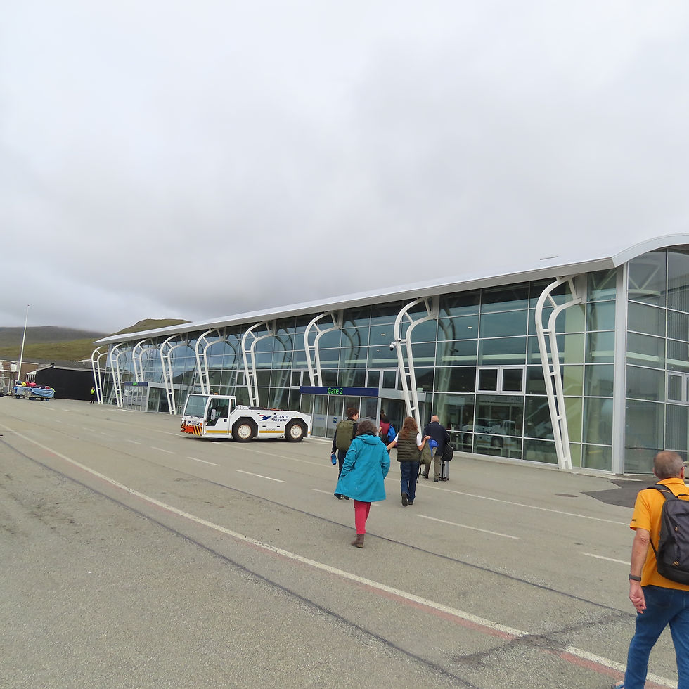
the air-port
We rented a car and had decided if there was no rain, we will drive north on to see the Múlafossur waterfall.
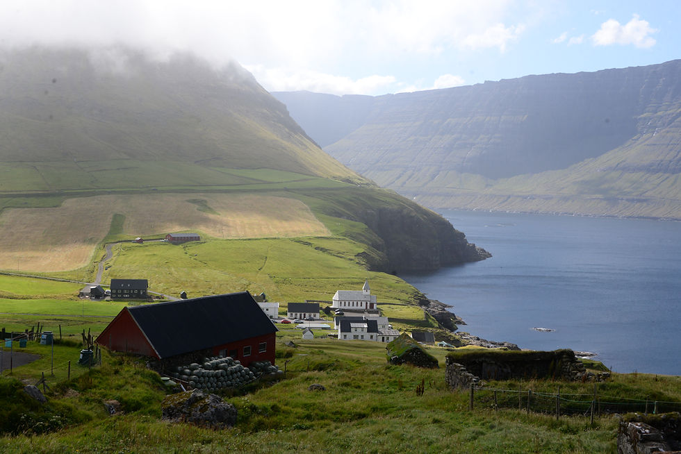
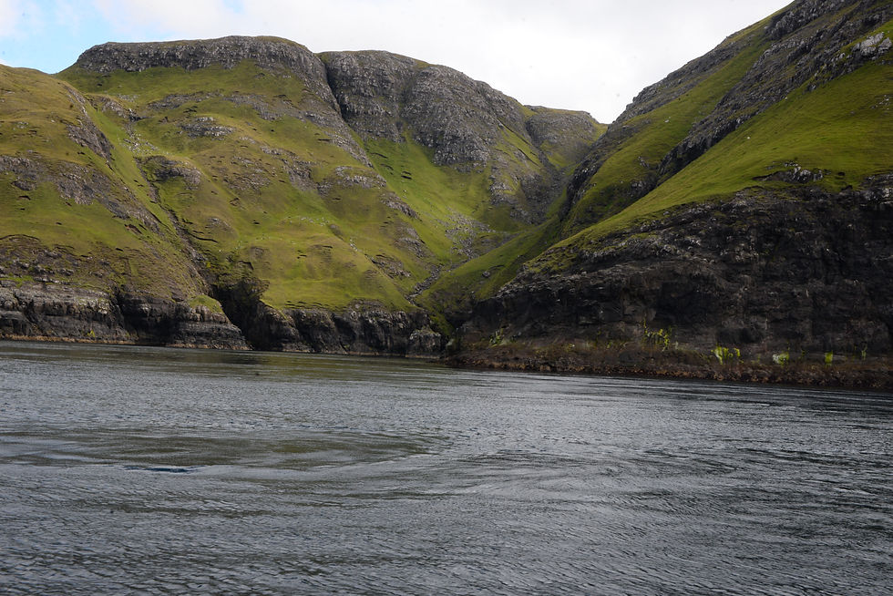
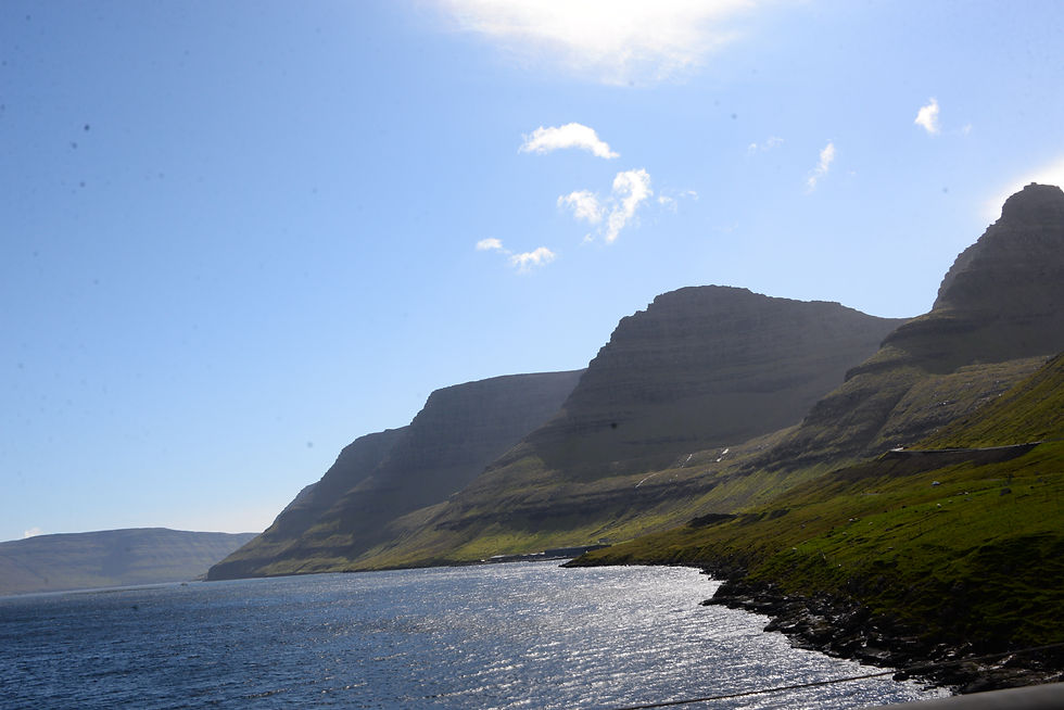
Leaving the air-port we were immediately overpowered by the beauty of the Sørvágur Fjord the clouds over the rocks gave a special almost mystic atmosphere to the place. We stopped every few km to take photos.
The Sørvágur Fjord, the first thing you see leaving the airport
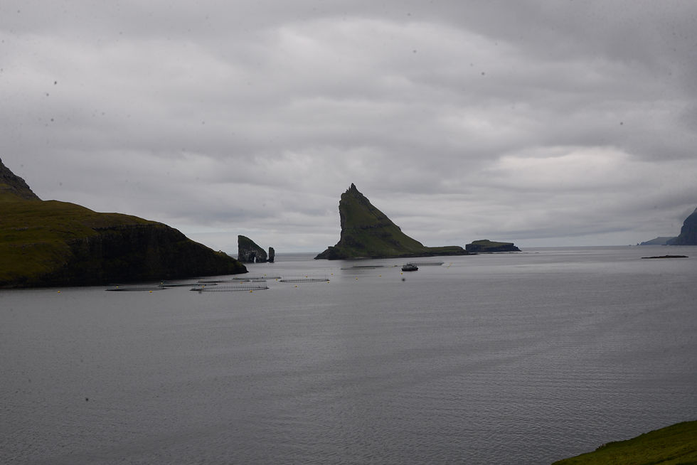
The two uninhabited islands at the entrance to the the Sørvágur fjord, to the right Tindholmur with its five peaks and to the left two rocks one with a hole or arch in it, Drangarnir, one little and one large.


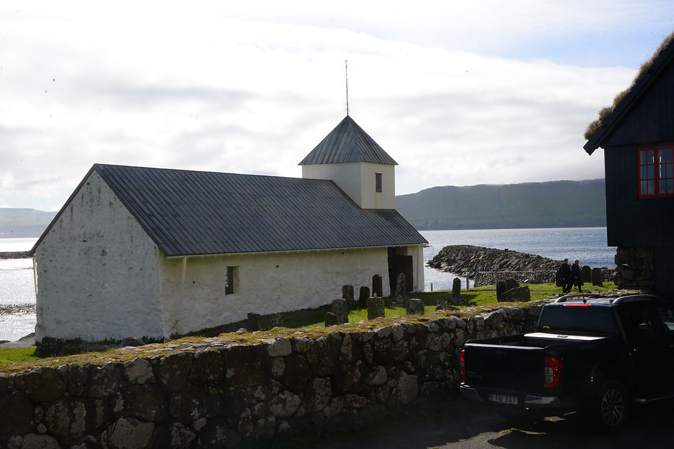
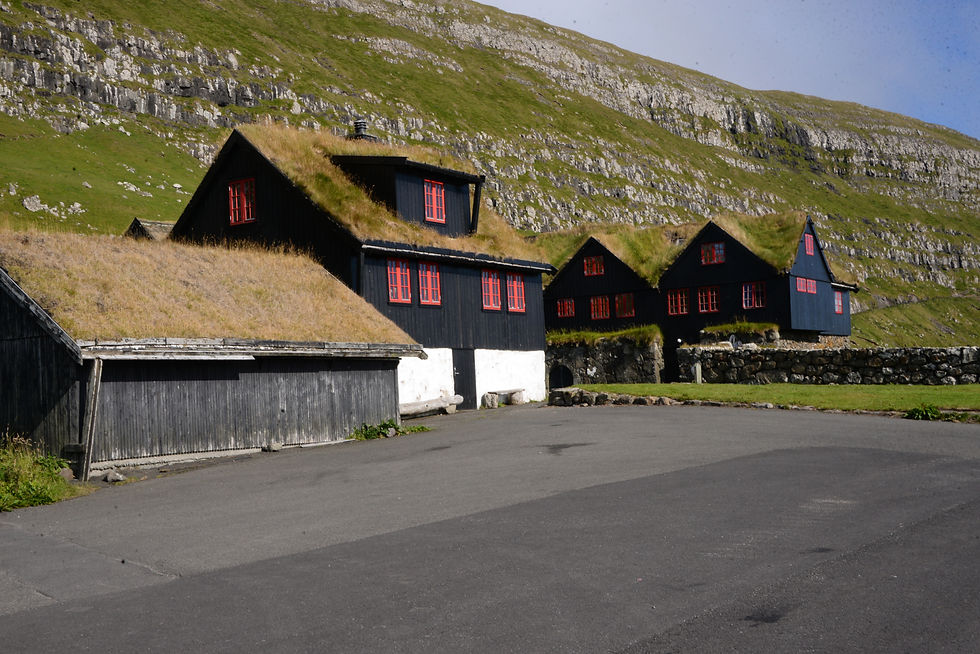
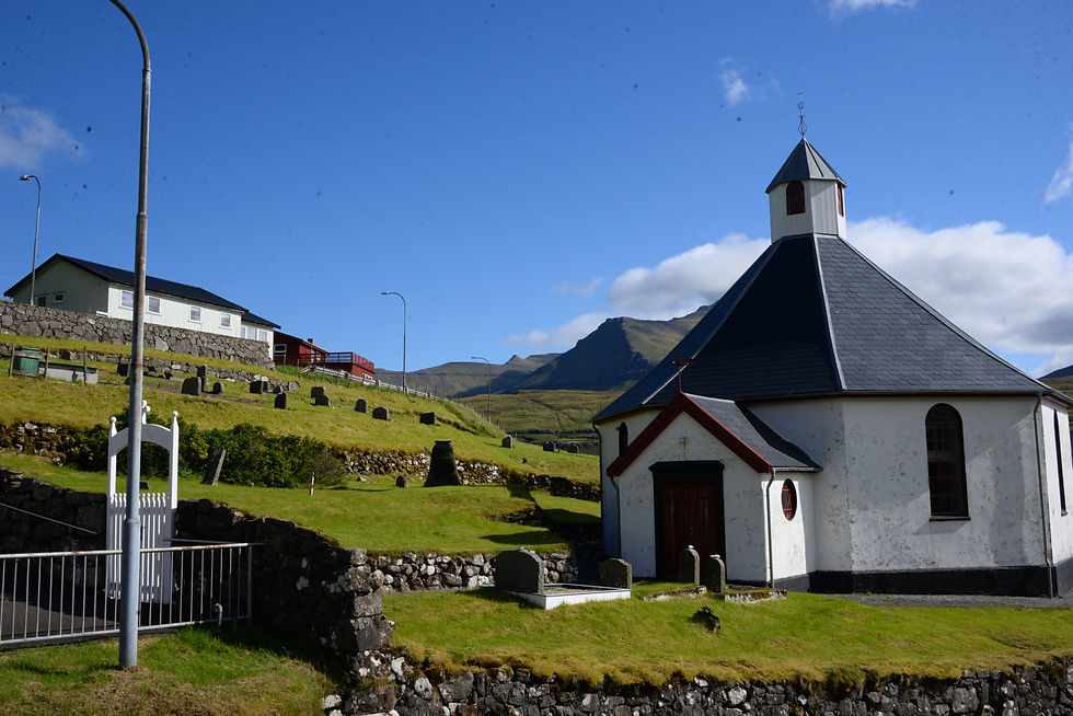
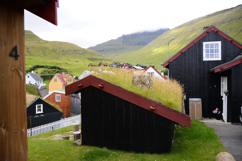
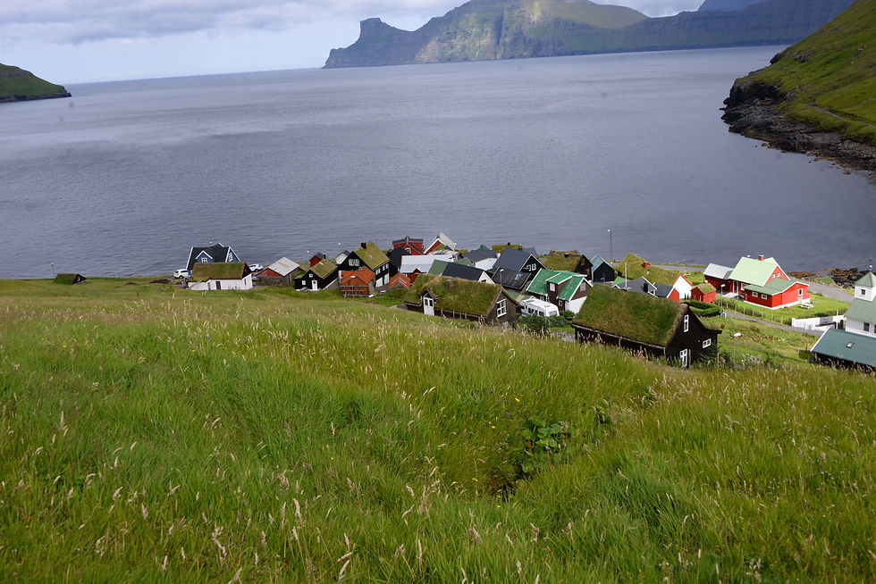
Bøur, a very beautiful and pastoral village. Having just arrived to the Faroe Islands, it is surprising as out of a fairy tale. The white church can be seen from far almost as a lighthouse. the houses with grass on their roofs, today I may say typical of the Føroyar.
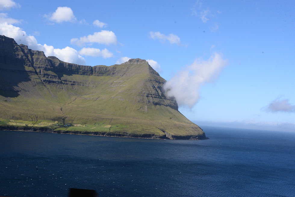
We continued driving north to Gásadalur.
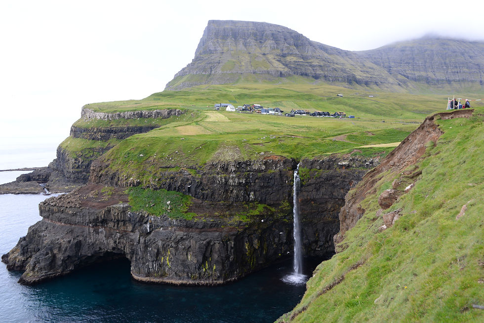
The Village of Gásadalur, under Árnafjall mountain (722meter) and the waterfall Múlafossur; the water falls 150 meters into the sea.
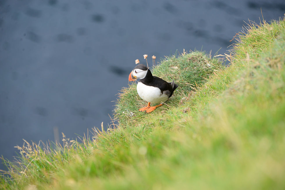
We saw a puffin there, it seemed very curious looking at me but it stayed in place and allowed me to take ten photos of it before it tired and flew away.
Notice the tunnel half way up the mountain.
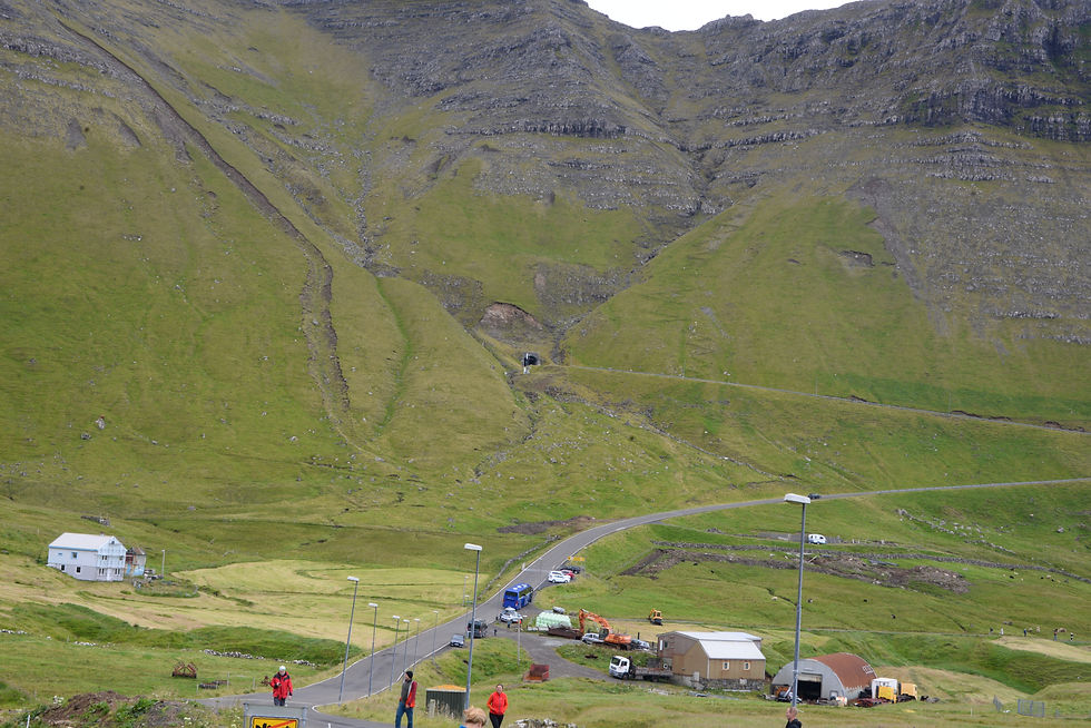
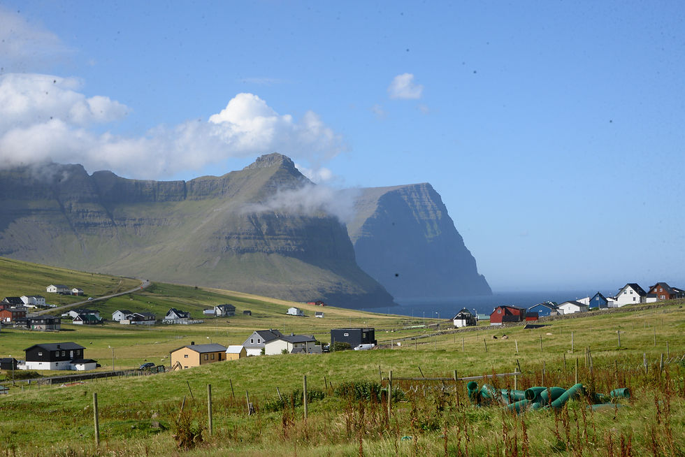
This small village of Gásadalur was connected to the road and the rest of the island only in 2006 when a tunnel was cut through the mountain. Until the opening of the tunnel the postman walked 2-3 hours each way a couple of times a week and a helicopter used to bring in necessities or if an emergency arose. There is no church in this village so when somebody died, the deceased had to be carried over the mountain to Bøur for the funeral in consecrated ground. Today 16 people live permanently in the village of Gásadalur . But now the 1.4 km long tunnel takes you through in no time.
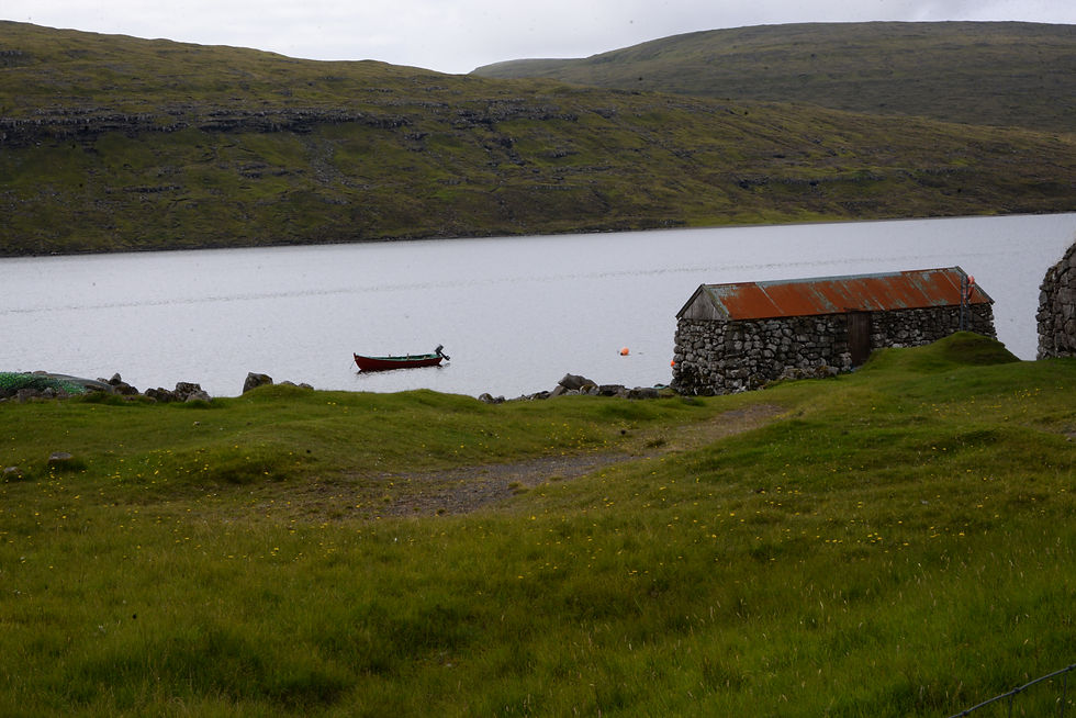
The largest lake in the Føroyar is just outside the airport and called Sørvágsvatn that is if you come from the village of Sørvágs; however, if you live in the villages of Miðvágur and Sandavágur to the east, it is called Leitisvatn, so neighborly skirmish is also part of everyday life in this far corner. In a diplomatic compromise everybody else in the Føroyar call the lake ‘Vatnið’ ("the lake"). The lake is located high above the ocean and has a beautiful waterfall falling 40 meters into the ocean below. It was not allowed to go there because of nesting birds, so we did not although we saw a number of cars whose travelers appeared to have disregarding this warning.
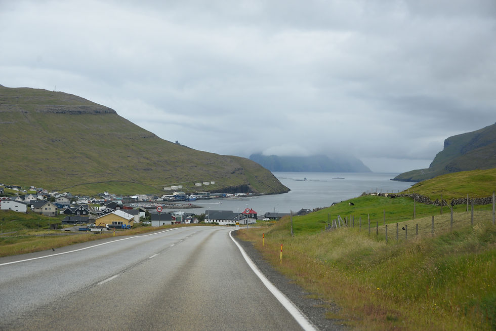
We started to drive towards Torshavn, where we had a reservation to stay for the duration of our trip.
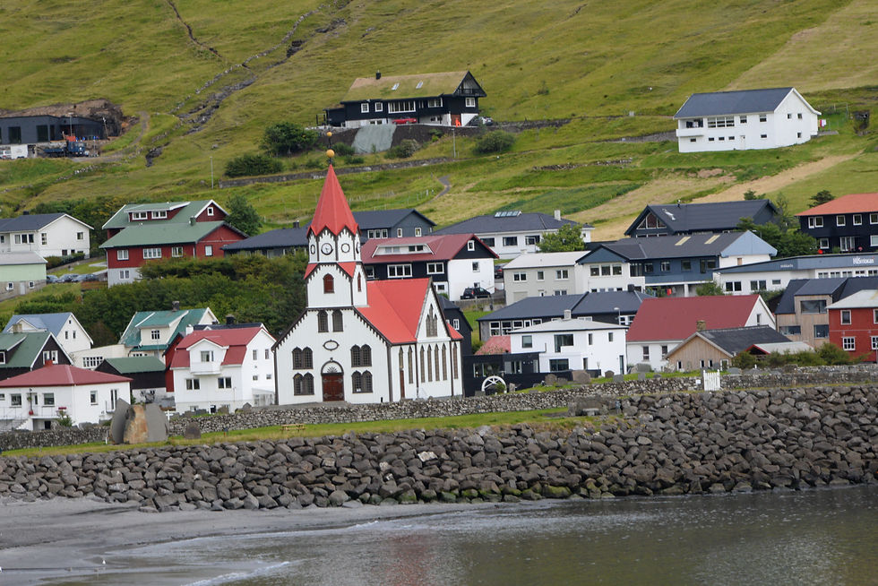
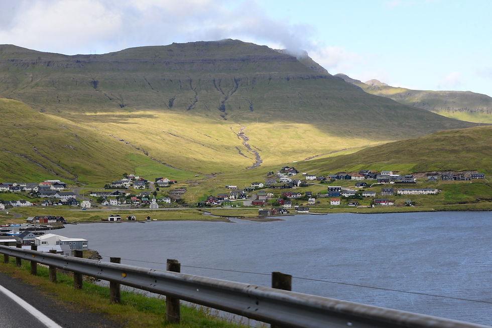
We passed Sandavágur with the red Church, which is different from most of the churches we saw.
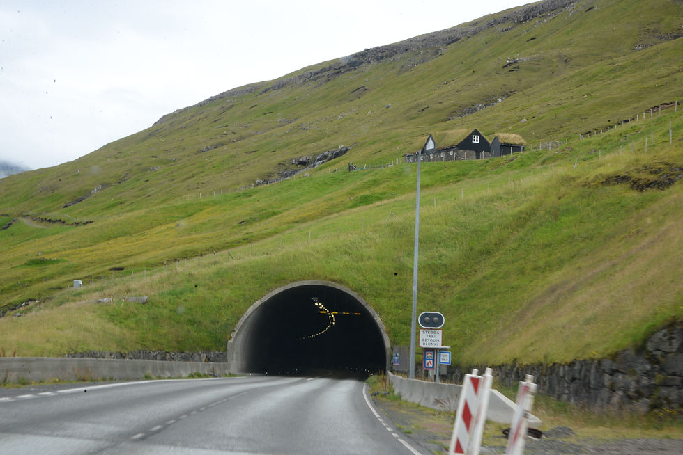
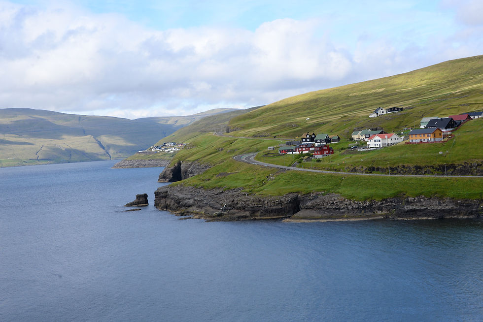
The tunnel between the two islands Vágar and its neighbor Streymoy, the latter is largest of the Føroyar islands and where Tórshavn the capital is located where half the
population live.
The tunnel opened in 2002, it is five km long of them 2.5 km below the ocean floor in a depth of about 100 meters. Impressive engineering!

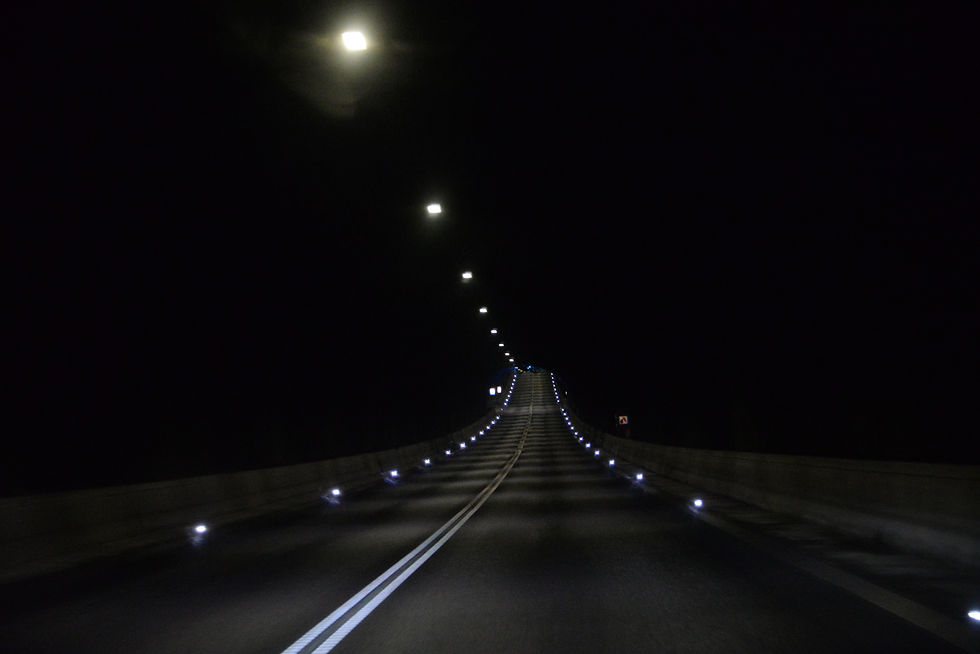
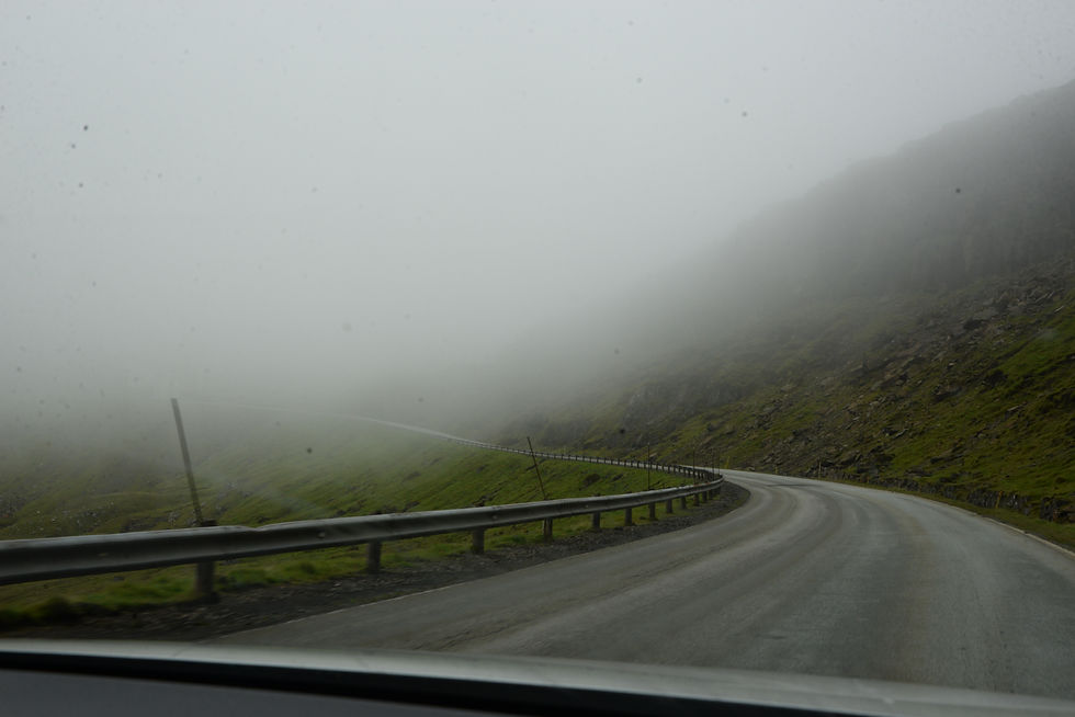
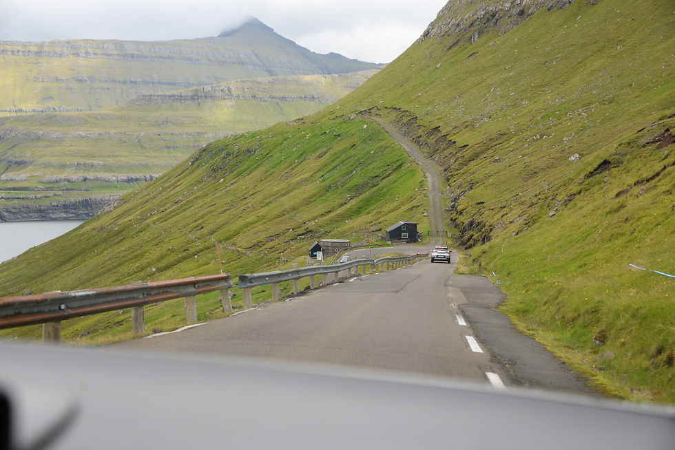
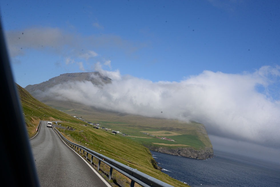
Our car’s navigation system took us on the road uphill along ‘The Island Road, so we drove up into the clouds with very little views; we met the perpetually munching sheep that were mildly curious about us, but as long as they had grass in their mouths, they let us be.

when the cloud cleared a bit
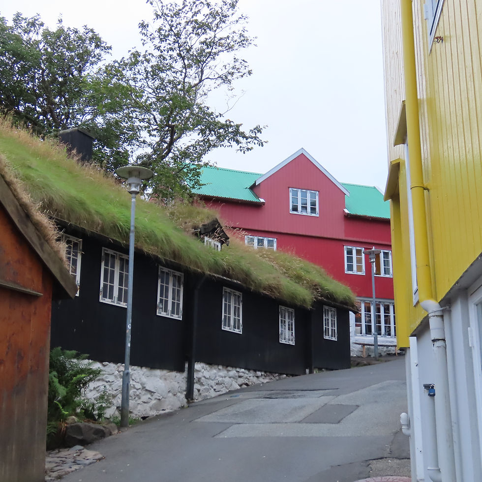
In the evening we walked around Old Tórshavn, very nice and authentic:


The next day we continued our trip to Vestmanna to sail along the steep cliffs, we were very lucky, we had sunshine, clear weather, blue sky; later it got windy, but we got many photos without clouds.

Vestmanna from the boat

Sailing along the cliffs we saw many birds flying, also puffins but they did not come out well enough to be put on my post! But this seagull was good enough I believe:
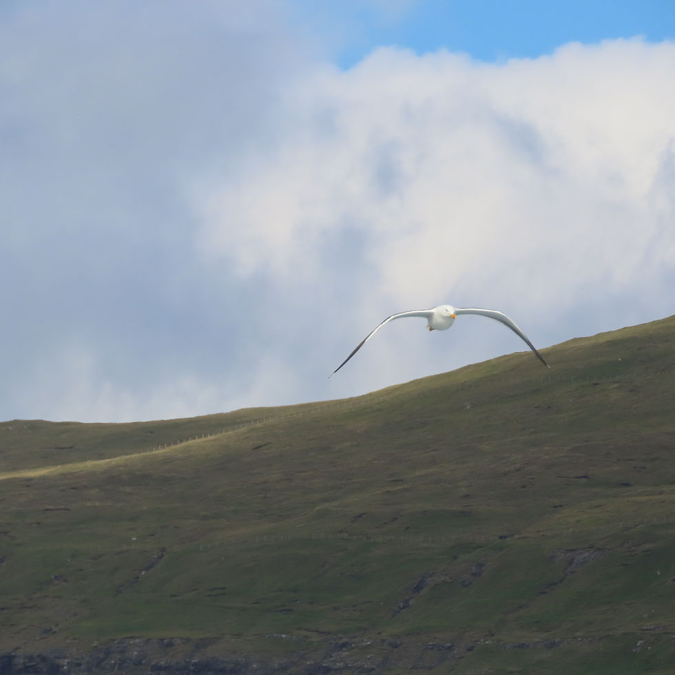
a seagull following our boat
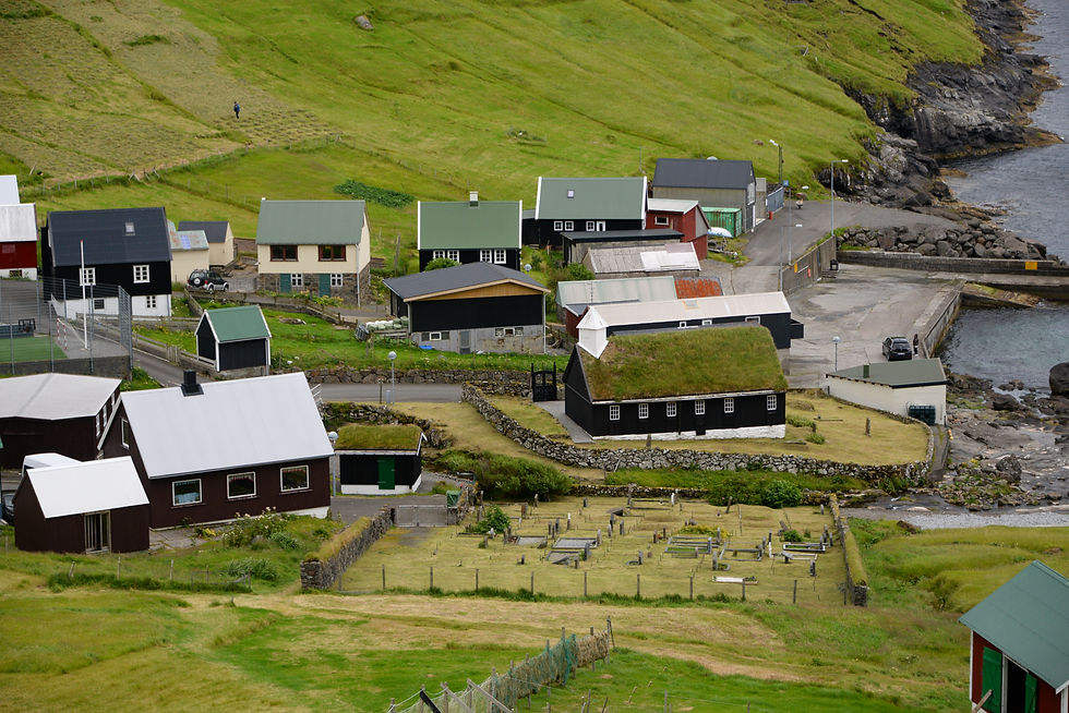
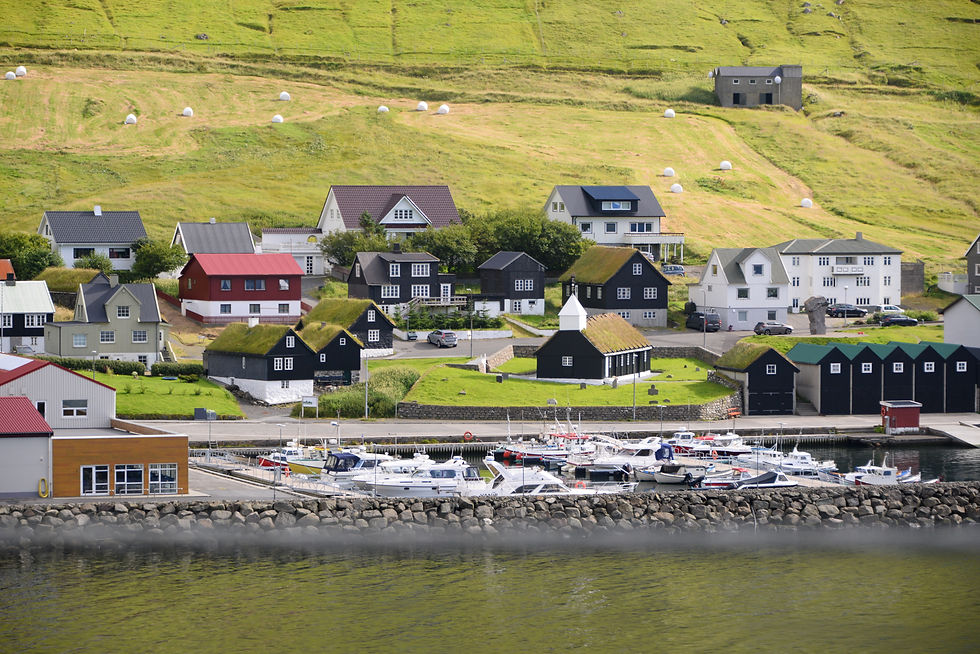
Along the roads you see these very picturesque villages; this is Kvivik
The weather was great so we continued to Kirkjubøur south of Tórshavn, which was the headquarter of the Catholic Church in the Føroyar; it lost this stronghold with the Reformation in 1538.
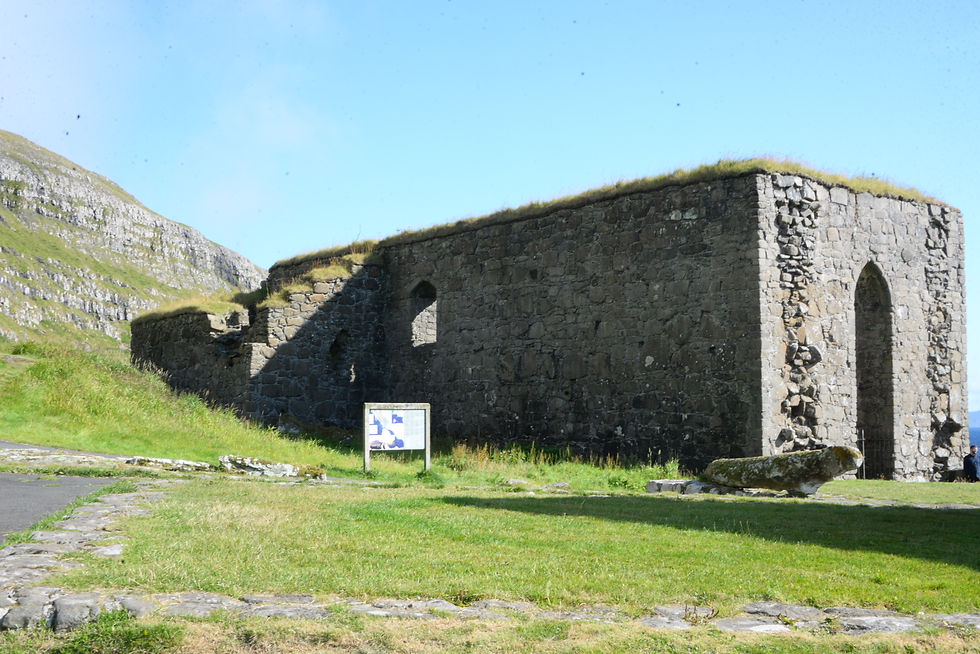
Magnus Cathedral from the 13th century, it was never finished as the population revolted against the bishop’s taxes, that was needed for the building.
The earlier Saint Olav's Church from year 1111 and is thus the oldest church in the Føroyar , and it is still in used as intended as a church.
Next to these churches is the old farm house Kirkjubøargarður, it was also built in the 11th century from drift wood that probably came in from Norway; interesting since 1550 the same family has lived here for 17 generations. We respected their privacy and only took photos from far.
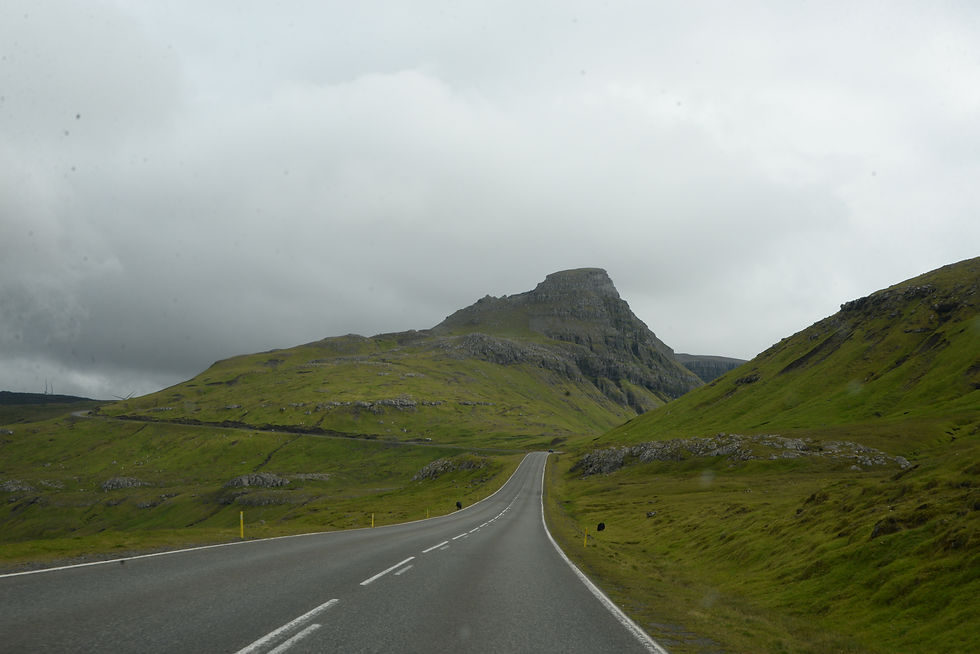
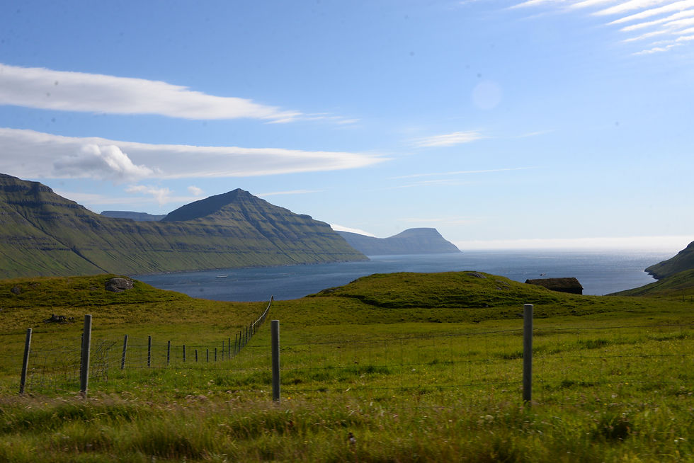
The landscape in sunshine:


A new day the weather forecast said in the morning rain from 2o’clock, so we went on a trip to see more
one should not waste a day with good weather, meaning weather without rain, we have to see more. You see just as much if cloudy, but rain is more difficult to tour around. We were really lucky.
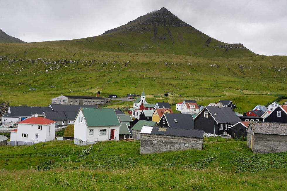
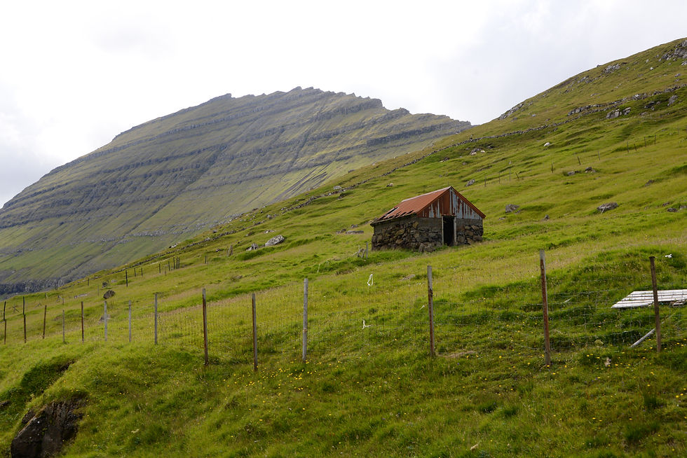
The different islands are alike but a little different.
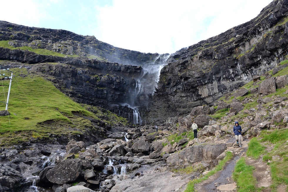
The tallest waterfall in the Føroyar, Fossá Waterfall 149 meter.
The octagonal church in Haldórsvík.

The village of Eiði, on the neighboring island, Eysturoy
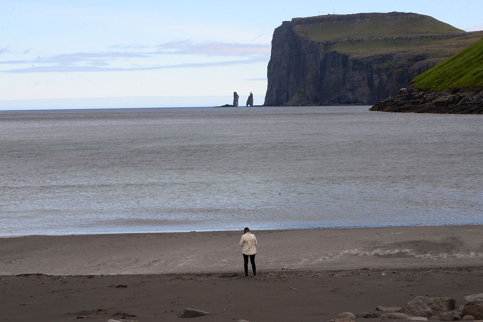
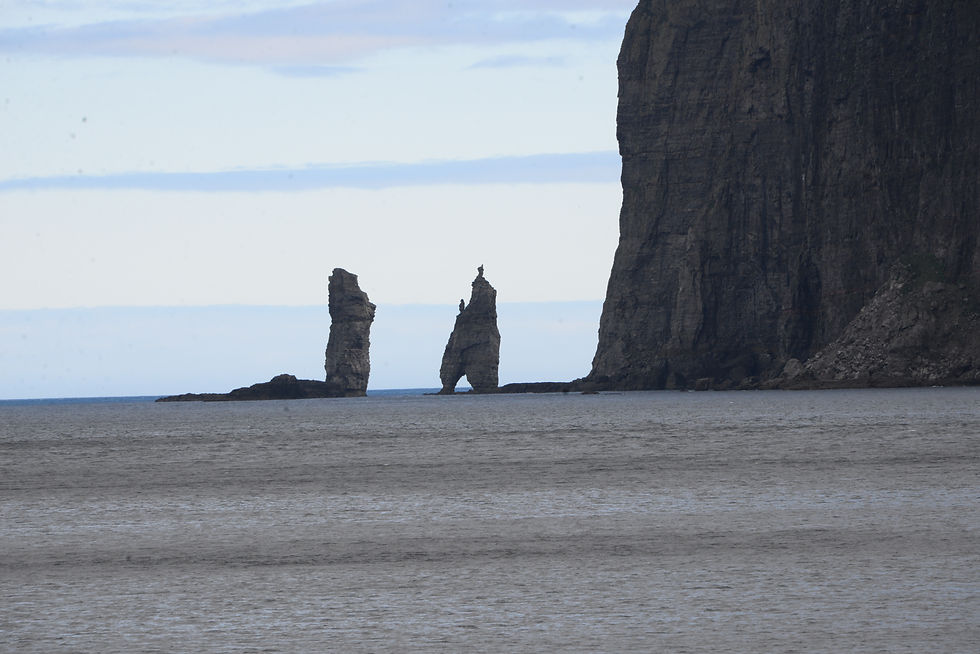
The view from the beach in the village of Tjørnuvík, towards the neighboring island of Eysuroy. You see these rock formations called Risin & Kellingin, the Giant and the Witch; the legend has it they were trolls from Iceland trying to move the Føroyar to Iceland, but it was difficult and it took time, they did not manage before sunrise which turned them into rocks and so they stand until today.

The bridge between the two islands of Streymoy and Eysturoy


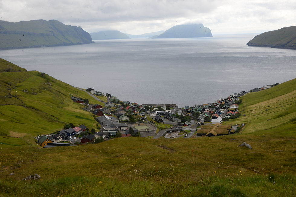
Crossing Eysturoy to Gjógv.

Gjógv and the natural harbor a 200 meter long gorge
The village of Gjógv had quite many tourists, because it was a nice day.
Funningur village
Elduvík village
On our last day in the Føroyar the weather forecast said 100% chances of rain from 8 o’clock in the morning. but having become used to wake up early we saw beautiful weather, so we did take a trip that was somewhat unplanned but it was perhaps the most beautiful day of the four days we spend there!
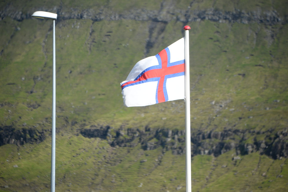
The flag is called Merkið (‘the banner), it is similar to the other Scandinavian flags. It was designed 1919 by a Føroyar student while studying in Copenhagen. During the 2nd world war, the British encouraged its use on Føroyar ships.
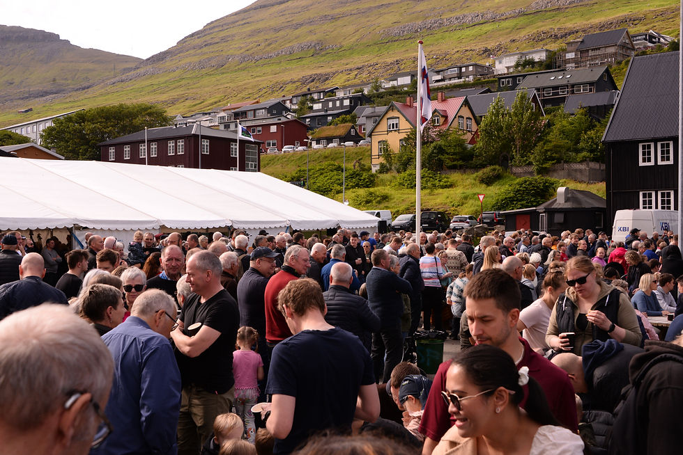
We came to Klaksvík on Borðoy where we found like a market day, many people it was the Seaman's day, very festive, many people of the Føroyar. There was free food and drink (not alcohol) also for us, the tourists. Festive, nice friendly, hyggeligt!
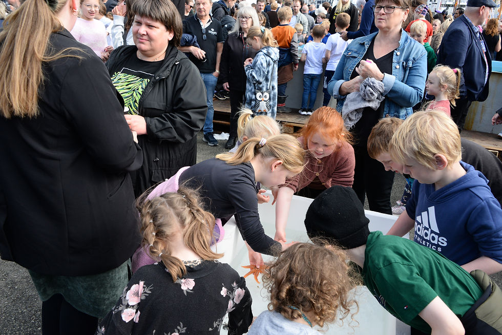
Seaman's day in Klaksvík on Borðoy. The children played with the fish and craps.
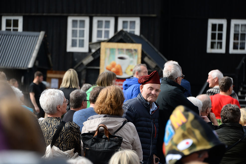
The traditional the Føroyar hat - My Dear wanted to buy one, but they were sold out in the shops.
We enjoyed ourselves but wanted to continue to our travelling and experience more sights in the very nice sunny weather. We continued in the direction of Viðareiði which is the most northern village of the Føroya, on Viðoy Island.
It was a beautiful day, wonderful landscapes, the contrast between the mountains coming tall out of the ocean, very green, the high sky that was very blue, very pastoral, unbelievable beautiful, but then we came to Hvannasund, where see saw the bodies of about 40 grind whales left for the seagulls to eat, the slaughter had happened perhaps a few days earlier.
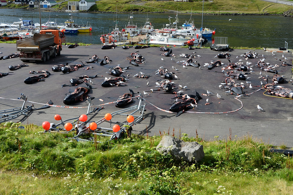
The seagulls had a festive meal but we disturbed them. It is a practice that has been in use since the 8th century and continue till today. About 700-900 whales are killed in this way every year. When we spoke with somebody about it they said that was how their forefathers survived the stark winter times. We were affected by what we saw, it made us quiet and were glad we did not witnessed the killing of the whales. We did not eat whale during our stay.
We continued and crossed the island by another tunnel.

A little bit of history: the people today who live on the islands speak an old Norse language, close to Icelandic, but different. The Danish rulers almost had it eliminated without a written language, Faroese, but the last 100-150 years they made a tremendous effort to revive it, develop a written language and even a first dictionary came out in 1996, that late. When the Føroyar obtained autonomy in 1948 after having been occupied during the 2nd world war by the British, Faroese became the official language.
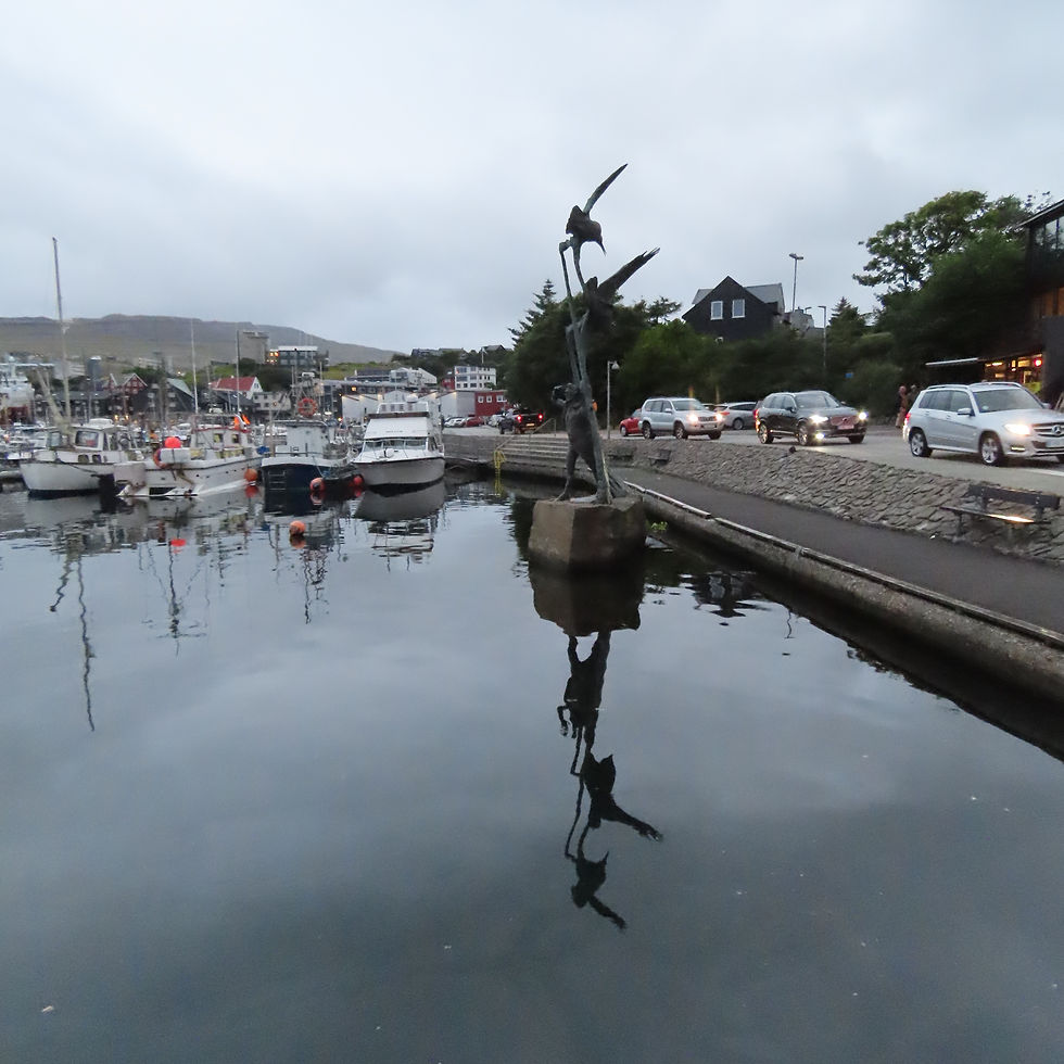
A statue of Nólsoyar Páll in Tórshavn Harbour, he is a local hero from the 18th century who tried to break the Danish trade monopoly. He was a poet and wrote "Fuglakvæði" (Ballad of the Birds), where the birds are the Danish authorities that exploit the Føroyar.
In the Faroese language the name of the islands, Føroyar, means the ‘Islands of the Sheep’; as a Dane I do not understand the language although to My Dear’s ear it sounds like Danish (he does not speak Danish, but is used to hearing it spoken).
The first settlers here were Irish monks in the 6th century; in the 8th century the Nordic Vikings arrived from Norway and established small villages and a parliament (Ting) like in Iceland; in one of the books, it said “they were remarkably democratic for the time” but of course when the catholic church in year 1000 took over everything, nobody, in particularly women, had any rights left. The islands were under the Norwegian Kingdom from 1035; the Denmark-Norwegian Union was established in 1380 and lasted until 1816 when it was broken up by Norway being transferred to Sweden, but the remained Danish.
It was a good experience to see this far away place, that is part of my home land. I did not know much about it, as we did not learn in school. There is one writer William Heinesen (1900 - 1991) he is considered an important Danish writer as he wrote in Danish and received many prizes. I did not find a book by him in Torshavn, the girl in the bookshop said he was not really Faroese, because he wrote in Danish. I also did not find a book by him in Copenhagen.
In my writing I have attempted to keep the Faroese writing, I hope I have succeeded.
The Føroyar are indeedvery beautiful and worth a visit if you like nature.
Comments